SpaceCraft: from capture to an editable plan
Development notes on separate floor-plan and 3D captures, plan editing and files for the next design task.
SpaceCraft is our room-capture app in development for LiDAR-equipped iPhones. We are working on the path from recording an existing room to inspecting it and taking usable files into design work. The app has not been released on the App Store.
Two captures with different purposes
RoomPlan records walls, doors and windows as a starting point for a floor plan. Textured 3D capture combines LiDAR with camera images to record surfaces and their appearance. These are separate sessions; their coordinates are not automatically aligned.
The development build includes a plan editor for walls, corners and openings, with undo and redo. The original capture is retained, so the recorded room and corrected plan remain distinguishable.
Inspect what was recorded
A capture needs to suit its intended task. Review missing surfaces, disconnected walls and uncertain openings. Check critical dimensions independently on site; device estimates alone do not establish that survey requirements have been met.
Take the file into the next task
Plans can be exported as PDF, PNG, SVG and DXF, and 3D models as USDZ and GLB. They carry different kinds of information. Open the file in the receiving application and check its scale, geometry and visible gaps as part of the handover.
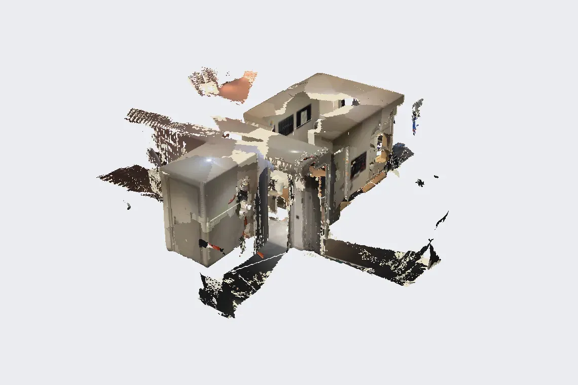
The image shown here is a real capture preview from the iPhone 2.0.0 (16) development build. Missing surfaces remain visible. Keeping those gaps understandable to the next designer matters more than making the presentation appear complete.
The next research question
When is a capture sufficient for a design decision? Coverage indicators and comparison between repeat captures are research directions we want to investigate. We would use them to test which gaps need another observation. Follow the current development scope at getspacecraft.app.